
This will be a short post designed to relay a few resources that I have used recently in writing my ebook on mobile learning field activities. The resources are London specific, but I suspect there are other resources for those wanting to do a few of their own mobile field activities. I am gearing these resources towards their use in history specifically, but I suspect they could be used with anthropology, architecture, geography, media studies, and art as well. It seems like several of these resources are already being used for a course from London School of Economics (LSE) on London’s Geographies: An Introduction to Cultural and Historical Geography. I also have an idea to use these for a particular project I am working on, but don’t feel comfortable just yet revealing what that is as I haven’t finished working on (or articulating) it yet. So for now, just the resources.
PhoneBooth: Booth’s Poverty Map, Mobile Version
I am pulling much of this from the London School of Economics (LSE) Library as they did some impressive work with this. They are in the process of creating a mobile app for the Booth Poverty Survey Maps of the late 19th century in London. A beta version is available now. Charles Booth was a successful businessman in the 19th century who eventually turned his attention to the social ills of London, particularly poverty. According to the LSE website:
In 1884 he undertook to assist in the allocation of the Lord Mayor of London’s Relief Fund, by analysing census returns. From this he discovered the highly unsatisfactory nature of the censuses, and would later become a member of the official committee in charge of the 1891 census and make a number of recommendations for its improvement. In the autumn of 1885 Henry Hyndman published the results of an inquiry into poverty conducted by the Social Democratic Federation, which claimed to show that up to twenty-five percent of the population of London lived in extreme poverty. In early 1886 Booth visited Hyndman, who records in his autobiography that Booth told him that “in his opinion we had grossly overstated the case” and that he would himself be undertaking an inquiry into the condition of workers in London. The first meeting to organise this inquiry was held on 17 April 1886: the work would last until 1903, resulting in the publication of three editions of the survey, the final edition of Life and Labour of the People in London (London: Macmillan, 1902-1903) running to seventeen volumes.
So Booth produced this impressive survey into poverty in London and mapped it complete with color coded sections of town. The resulting maps were the result of painstaking work:
In the ‘Survey into Life and Labour in London’ (1886-1903) Charles Booth and his investigators attempted to understand the lives of Londoners through a detailed investigation of their places of work and working conditions, their homes and the urban environments in which they lived, and through the religious life of the city. Investigators interviewed factory owners, workers and trade union representatives at their places of work or in their homes. They visited ministers of religion and their congregations. The survey notebooks record first-hand the comments of interviewees and investigators and contain a wealth of information about the living and working conditions of Londoners in the late 19th century. (LSE website)
The maps themselves are beautiful and as they are now available via a mobile browser, they are quite useful for those wanting to initiate a few mobile learning field activities in and around London. Another blogger has produced an interesting collection of maps detailing the changing layout of Whitechapel over the last hundred years or so, some of which include the Booth Survey Maps as well for an interesting take on a particular neighborhood.
LSE also manages the Charles Booth Online Archive, which has digitized the maps and, perhaps more importantly, many of Booth’s notebooks he took while compiling the survey. There are additional resources there on life in London at the time. These resources alone are enough to conduct a fairly extensive mobile learning field activity for your learners, having them document the then and now of a neighborhood, trace the poverty of London over time, document the architecture, etc. The following resource provides an even great depth for this exploration.
Street Life in London (1876)
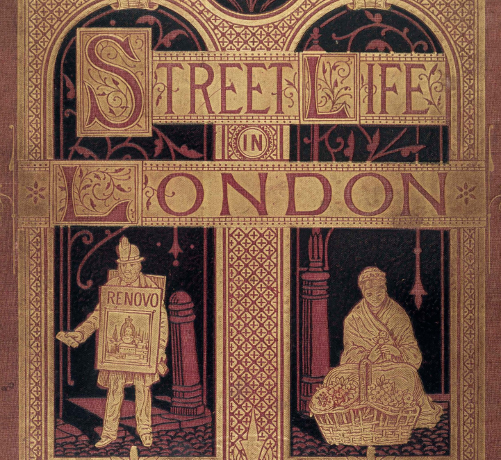
LSE maintains this resource as well (good on you, LSE, for all the useful resources). It is available for free as a PDF download and is a rich, incredibly rich resource for documenting the history of London. I would have my learners devour this book, refer to the Booth Poverty Map, identify a neighborhood, street, or location to investigate, capture media from the site, and assemble that all into one composition. I might be doing this myself in the very near future. Introductory text from the LSE site:
Street Life in London, published in 1876-7, consists of a series of articles by the radical journalist Adolphe Smith and the photographer John Thomson. The pieces are short but full of detail, based on interviews with a range of men and women who eked out a precarious and marginal existence working on the streets of London, including flower-sellers, chimney-sweeps, shoe-blacks, chair-caners, musicians, dustmen and locksmiths. The subject matter of Street Life was not new – the second half of the 19th century saw an increasing interest in urban poverty and social conditions – but the unique selling point of Street Life was a series of photographs ‘taken from life’ by Thomson. The authors felt at the time that the images lent authenticity to the text, and their book is now regarded as a key work in the history of documentary photography.
And the photographs are something to see. They focus intently on people performing their work, less so on vistas and skylines. On the street and quite urgent. Just a sample below.
So these resources taken together provide a particularly good primary source base in which to engage some field activities of your own. My ebook talks quite a bit about how once can do this (logistically) with a group of learners, recording media and composing representations or impressions. More to come on that front, but in the interim, consider using these resources from LSE. They are accessible mechanisms for making local history come alive with your learners. For those not in London, find the equivalent in census records, historical accounts of your locale, newspaper archives, maps. It might be a bit harder to cobble it together than these resources for London, but it is worthwhile to do so. This is how we make history come alive; we embed our historical learning in the places themselves.