
In response to one of the learning activities for the #MobiMOOC course being conducted now (wiki or follow #MobiMooc or the Google Group), I am attempting in this post to show how I would use an mlearning tool (QR code, audio/video) for learning.
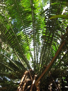
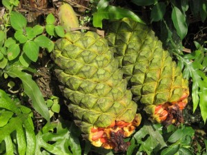
I had done some work awhile back on creating a skeleton of a course design for a project I work on (JSTOR Plant Science), a project dedicated to plant scientists, plant taxonomists, and the rapid identification and classification of all the world’s plant biodiversity. It is wonderful to see the network of scientists performing their work, but I had wanted to create some accompanying materials for teachers and students who wanted to explore these a bit more in their courses. Generally, this information was aimed at novice level learners (thinking primarily secondary school), but as this is a field science, it seemed entirely appropriate to have elements of mobility laced throughout the course design. To get people into nature to perform natural science, that sort of thing. How can one fully understand plant life without actually touching the thing? The texture alone is a worthy topic of investigation.
I threw all of the skeleton onto a Wiki (Course Design: Plant Science), which is still there, half-completed. Now the course is a lot more rigid than I would design normally, but that owes a lot to the scientific rigor of the discipline itself. It is less about applications of the plants and more directed towards the taxonomic classification of them. So there a lot of potential threshold elements that need to be addressed and surpassed for students to really think like scientists, to explore with that kind of exactitude (and without boring them).
One of the lessons, more of a reflective/constructive activity, involved the students in the field (ie, outside the school) armed with any mobile device that allowed for photos to be taken and sent. Basically, the goal was to have the students choose a plant they saw, send it to a centralized datastore (blog or wiki instance) along with descriptions, locations (ideally GPS coordinates, but manual descriptions are sufficient). The students would then collect around this data instance and discuss individual plants, how they are classified, where they are found.
For this, I would use Posterous (although Tumblr is probably sufficient as well) as it allows for multiple authors to post to collected spaces. The students could all post their images and descriptions from their mobile devices while in the field. Data could be discussed when they had returned or even remotely as well (via automated SMS messages once the blog was updated; students could then respond to each other’s posts to discuss or avoid duplicates). I imagine it would also be possible (if GPS was enabled) to automatically plot these entries onto a map (Posterous automatically will add photos to a centralized Flickr account as well and that then could be plotted, perhaps).
Michael, nice to meet you, I am still puzzling about a project. Your down-to-earth description with apps mentioned is welcome to me. I will bookmark this blog. My mlearning course will use video or photo, like yours. But the subject will be ‘critical thinking’ as far as I know now. Wish you all the best with this project, it looks fine to me. Jaap Bosman Netherlands
Hello there Jaap, Good to hear from you. Happy to help with a project if you need any help at all; don’t hesitate to email me at gallagher.michaelsean@gmail.com. We can work together on it. I am focusing currently on the science project I described, but am doing research on mobile learning for Humanities (History, Literature, Cultural Heritage), subjects which require more critical thinking skills. So, I am interested in what you are describing in trying to teach critical thinking. Happy to work together with you a bit on this, so email me when you get the chance. Take care, Jaap!
Awesome idea and I am just behind you in thinking about a simple project I can create for this class. I created a blogger blog for a project described here: http://bit.ly/h0L9BRhere is the blog: http://mobimoocexperiment.blogspot.com/I wonder if I can get a few folks to participate and more importantly, can I figure out the technicalities?
That could certainly work, Todd. Heading down the right path on that one. In fact, mobile seem ideally suited to the sciences, especially the field ones. Why not allow them to input/converse about the data from the field itself? Sounds right to me. Does Blogger support submissions by mobile? I haven’t used it for awhile. If they don’t, several others do, including Tumblr and Posterous. Posterous in particular accepts almost anything and will take images in posts and automatically upload them to Flickr and centralize everything (including reposting to Blogger or WordPress). Sometimes it takes a lot of workarounds! Either way, if Blogger supports it, I am game. However ironic this might be, I actually left my new work issued phone at work and need to wait to tomorrow to let you know my #. Will add my email address to the doc now though. Great idea, Todd!On a side note, China is doing some interesting work with plant identification by getting everyone with cameras and GPS coordinates systems (most of the phones have that now) and submitting photos from the field. This is all done towards preservation, but it gets much easier when you have hundreds of millions amateurs as opposed to a 100 or so scientists to collect the data. We can leave the analysis to the experts, but collections can be made by anyone!