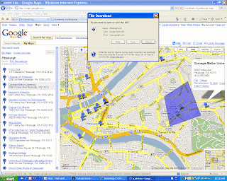
I want to draw your attention to some of the more advanced features, if I may be allowed. Notice the purplish square above. You can highlight certain areas of the map to illustrate a focus, just as you would on any Office program. In this case, the square refers to the environs of the beginning chapters of the novel Mysteries of Pittsburgh by Michael Chambon. They are running around Oakland for most of the first thirty pages so far.
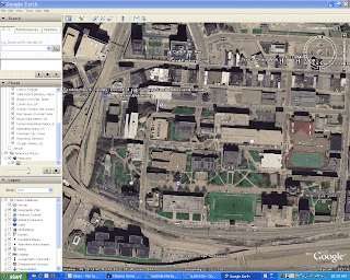
Another feature, which my cursor is pointing to in the above screenshot, is KML. KML stands for Keyhole Markup Language. Basically, it is the process by which satellite imagery is mapped onto conventional maps, such as the one above, and vice versa. Metadata has to be added to any map to enact a transition to another kind of map, say from satellite images to conventional images. By clicking KML (notice the box asking me if I want to Open or Save the KML document), this information that I have mapped here (with my little placeholders) will be mapped directly into Google Earth so I can see the satellite equivalent. It is a very complex technology that is becoming very accessible due to the Google people. The first image is the information from Google Maps mapped into Google Earth, specifically my old university as seen from space.
Just click on the title header to go to the map in Google Maps.
Pittsburgh and technology are cool.
